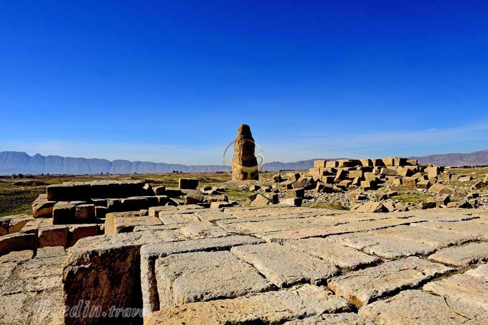
The Sassanid period begins, officially, with Ardashir’s accession to the throne instead of the last Parthian ruler of Iran in Ctesiphon in the year 224 A.D. Sassanid art, however, has its genesis in the art produced by the Parthians and by the local kings of Persis(Fars) well before that date. Ardashir began his brilliant reign with a series of successful military campaigns. The treasures he acquired during his expeditions to Esfahan, Elymais, and Kerman permitted him to found the town he audaciously called Ardashir-Khwara (Ardashir’s Glory), and make it his capital. The town was later known as Gur (Jur in Arab texts), and is today’s Firuzabad. Ardashir seems to have built the first palace there before his victory over the Parthians. Because having a city called by one’s name was a strictly-observed royal privilege, his act provoked the Parthian king Artabanus V, Ardashir’s sovereign at that time, to attempt to punish the rebel – an effort which ended in his own defeat. Some scholars believe that a flourishing settlement has existed on the site of Gur since the Achaemenid period. It was, however, buried under water when a dam was built in its vicinity during the Seleucid rule. Under Ardashir, Borazeh Hakim, one of the most illustrious of the ancient Iranian architects, is said to have successfully broke the dam down and built the city anew. The new town was a perfect circle in plan, and archaeologists are still lost in conjectures about how such a layout could have been achieved. The city occupied about 300 hectares and was enclosed by a lofty mud-brick rampart and a moat 50 m wide. Two axes, intersecting at right angles, divided the town into four equal parts. At their ends, these were marked by four gates – the Gate of Hormoz inthe north, the Gate of Ardashir in the south, the Gate of Mithra in the east, and the Gate of Bahram in the west. The four parts of the town were further divided into sectors, each surrounded by a separate wall in such a way that if the enemy succeeded in occupying one sector, he would have had to storm another rampart before taking over the next. The center of Gur was occupied by a governmental district consisting of a circle with a radius of less than 1 km; it served the purposes of the court, and was also separated from the rest of the town by a wall. The intersection of the town’s cardinal axes was marked by a tall tower, often called the Minaret. This square structure of rubble stone and gypsum still rises to a height of about 30 m. Each side of the lower part of the monument measures about 11 m. The minaret was ascended by an outside staircase whose steps decreased in width as they ascended.